Live Updates: Caldor Fire reaches basin, jumps Highway 89 as South Lake Tahoe evacuates
READ MORE
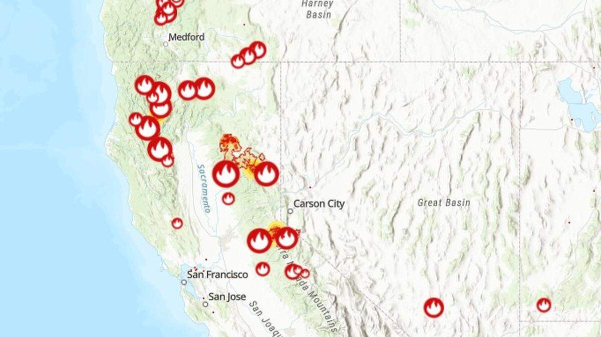
California Wildfires
The latest on the wildfires burning in California. Get updates on the Caldor Fire, Dixie Fire and others, including size, containment, evacuation orders and more.
Expand All
Read the latest updates: Caldor Fire burns closer to South Lake Tahoe
Original story
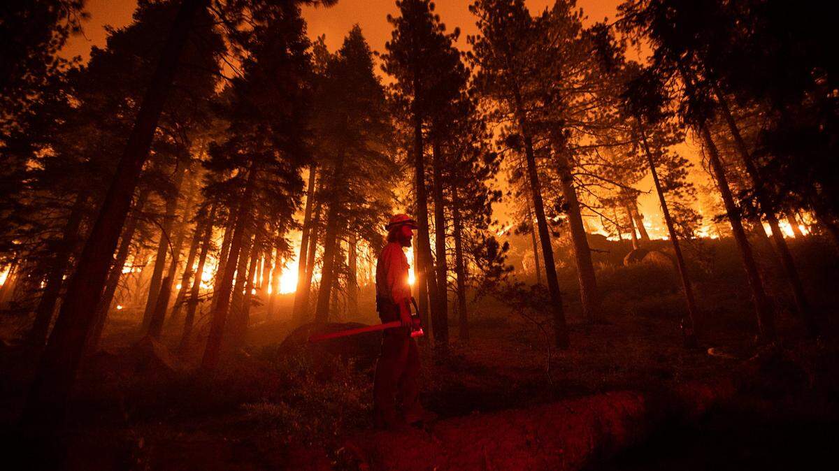
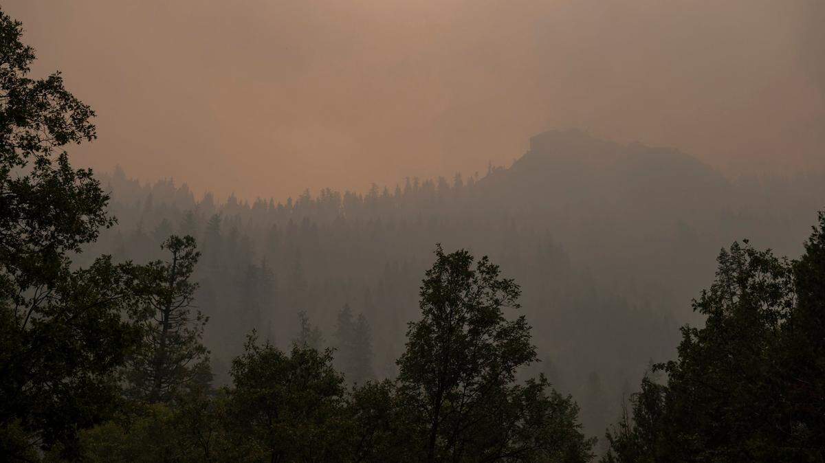
The Caldor Fire entered the Lake Tahoe Basin on Monday, hours after the entire city of South Lake Tahoe and surrounding areas along the west and south shores were ordered to evacuate.
The formal exodus came after South Lake Tahoe’s roughly 22,000 residents were given an evacuation warning late Sunday, told to be ready at a moment’s notice to evacuate. Nearly 30,000 residents had already been evacuated from the eastern half of El Dorado County.
Hours after practically the entire population fled, the fire pushed beyond Echo Summit and into Christmas Valley, a few miles south of the city, intensifying fears about the danger to populated areas along the south shore of the lake.
Earlier in the day, at 10 a.m., fire and sheriff’s officials upgraded the warning to a mandatory order for all but the northeastern corner of the city, near Stateline. Authorities expanded the order at 11 a.m. to include the entire city.
The city in a Facebook post said the evacuation “will be done systematically by neighborhood.”
“Stay calm, gather your go bags and important items, and execute your evacuation plan,” city officials wrote.
Those evacuating from South Lake Tahoe should leave eastbound on Highway 50 toward Nevada, Cal Fire and sheriff’s officials said.
By Monday evening, the fire had reached the Christmas Valley area, south of Meyers and not far from the southern edge of South Lake Tahoe. Sacramento Bee journalists saw flames on the eastern side of Highway 89, just south of Meyers. Later in the evening, journalists saw the fire jump to the west side of 89.
Much farther south, the fire crossed Highway 88 and was headed toward the Kirkwood area.
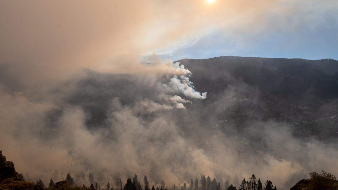
Federal officials said the fire grew to 186,586 acres Monday night, with containment at 15%.
Cal Fire Assistant Chief Brian Newman said the presence of fire in Christmas Valley was particularly worrisome. Although the winds weren’t as strong as initially forecast, they were pushing the fire toward the evacuated city of South Lake Tahoe.
“We are definitely concerned about it burning north” toward the city, he said. He added that the overnight conditions would be critical as strong winds were expected to continue.
Thom Porter, director of Cal Fire, said the fire grew by more than 20,000 acres Sunday after an inversion layer — which moderated the fire’s behavior temporarily — lifted.
“When air clears, it’s taking the lid off your pot of boiling water; all of a sudden there’s that plume of heat and steam that comes out. Same thing happens on a fire. Also sucks in oxygen from all directions, puts fire and spot fires in all directions,” Porter said. “That’s what happened yesterday.”
Although the fire at midday was “held up on that ridge where it would drop into the basin,” he said wind-blown embers were causing spot fires in Lower Echo Lake, Aloha Lake and Desolation Wilderness.
“There’s fire in the basin.” A week ago he said he was fairly confident the fire wouldn’t make it into the basin.
He said it marked only the second time in recorded history a fire crossed from one side of the Sierra Nevada to the other. The first came just a few weeks ago, with the Dixie Fire.
And, in a sign of how resources are being strained nationally, Mark Ghilarducci, the head of the state Office of Emergency Services, said California lost the services of a helicopter crew that had arrived days earlier from the Louisiana National Guard. Cal OES spokesman Brian Ferguson said the crew had been grounded with COVID-19 but was set to help with the Caldor Fire — only to have to return home to respond to Hurricane Ida.
Evacuation shelters have been established at the Truckee Veterans Hall and Douglas Community Center in Gardnerville.
Barton Memorial Hospital evacuated its patients Sunday night and will transfer its emergency services to the Lake Tahoe Surgery Center in Zephyr Cove, Nevada.
All four big casinos, on the east shore in Stateline, were still open Monday evening. The Hard Rock operated as a makshift command center for fire and law enforcement. The MontBleu housed evacuees and firefighters and kept its casino operating — but only the slot machines.
A few guests were drinking and playing the slots at Harrah’s as Frank Sinatra music played over the sound system.
Douglas County, Nevada, the county along the east shore of Tahoe, still wasn’t under a mandatory evacuation order, although portions of the county outside the Stateline casino corridor were placed under a warning Monday night. Nevada Gov. Steve Sisolak declared a state of emergency.
Live update from South Lake Tahoe at 6 p.m.:
Live update from South Lake Tahoe at 5 p.m.:
‘It’s terrifying,’ Tahoe evacuee says
Much of South Lake Tahoe was evacuated by 11 a.m., with stragglers rushing to get their belongings into vehicles. Police drove through residential areas, using loudspeakers and sirens to order people to leave and directing them to head north on heavily congested Highway 50, along the east shore of Tahoe, as the main route out of town.
“Vacate the area immediately,” one law enforcement officer said over a loudspeaker, adding that Highway 89 and westbound 50 weren’t accessible.
On 12th Street, Jess Anderson, his ex-wife Corinne Kobel and their 11-year-old son Ethan were hurriedly packing vehicles in an otherwise empty neighborhood.
“I got a knock at 10 p.m. last night with a warning to be ready. At 10 a.m. this morning, it was the sheriffs kicking us out,” Kobel said.
As she spoke, a Winters police SUV drove down the street, with officers ordering her family to leave immediately over the loudspeakers.
“I am freaking out,” Kobel said. “It’s closer to my place than (her ex’s place), and for an entire town to be evacuated, that’s pretty intense. And it’s red flag warnings for today and tomorrow so that’s not in our favor. It’s terrifying.”
Her ex-husband, Anderson, a ski instructor at Heavenly, also was fretting about the weather forecast. “With the winds and stuff, that whole area is loaded with fuel.”
Kobel said the closest thing to the Caldor Fire she’d ever witnessed was the Angora Fire, in 2007. “But that way that was burning, it wasn’t a super threat,” she said, adding that she’s grateful to the firefighters.
“They’re doing their best, these poor guys. They’re working so hard in this terrain. Can you imagine what they’re up against?”
Just down the street, D.J. Evans and his girlfriend Karlyn Malicdem were packing their vehicle with belongings and trying to deal with their stress.
“I think we’re looking at Paradise again,” Evans said. “I don’t want to give a sound bite but I think South Lake Tahoe is going to burn to the ground and I’m very scared. My stomach is in knots right now. I’ve thrown up twice this morning. I didn’t sleep at all last night. I’m very, very nervous.”
A long wait through Tahoe evacuation traffic
The evacuation caused bumper-to-bumper traffic along much of Highway 50 and other major roads in and around South Lake Tahoe, but motorists said it otherwise was proceeding without incident.
“It’s very orderly. It’s going slow but there’s plenty of police presence,” said Susan Kocher, a UC Cooperative Extension forestry expert who was leaving her home in Meyers, just south of the heavily congested Highway 89 intersection. “People are behaving nicely. ... I’m fine. The cat in the carrier is the one complaining.”
Kocher said local agencies had done an admirable job in recent years of managing the forests in the immediate vicinity of South Lake Tahoe, eliminating some of the vegetation. But she was worried about the prospect of spot fires “that could go block to block” and burn up people’s homes.
Meanwhile, at Harrah’s, Sandra Figueroa and her boyfriend, Samuel Stoddart, were sitting in folding chairs of the driveway outside the casino hotel’s registration desk in Stateline.

They evacuated from their Elks Club neighborhood home near Meyers at 10 a.m. Monday and had barely two hours to pack his pickup truck, her car, their boat on a trailer, mountain bikes, a paddle board and their yellow Lab, Bella.
They had hoped to move directly into a room at Harrah’s after arriving at 1 p.m., but at 4 p.m. they were still waiting to get in.
“It took us two hours to get here,” Stoddart said, adding that normally the journey would take 10 minutes.
But the evacuation created major gridlock throughout the Tahoe area, which lasted until about 4 p.m., when the traffic finally cleared up.
Figueroa said she expected they might be in for a wait.
“We’ve brought our chairs,” she said. “It was like, let’s just make the most of it.”
Tahoe west shore evacuations
El Dorado County sheriff’s officials also issued new mandatory orders Monday just southeast of the city limits, as well as communities along the west shore of the lake, which are popular vacation destinations.
Those included neighborhoods along Pioneer Trail, north of Elk Cub Trail through Al Tahoe Boulevard, according to the Caldor Fire evacuation map, as well as along Highway 89 from Emerald Bay up through the Placer County line on the west share of the lake, including most of the town of Tahoma. Highway 89 is open for those evacuating from the west shore.
Cabins burned near the summit Sunday, and critical fire weather conditions are anticipated starting midday Monday and lasting through at least Tuesday.
All city operations and facilities except public safety closed Monday morning until further notice, South Lake Tahoe city officials wrote in a Facebook post.
Mandatory orders were also expanded Sunday into parts of Amador and Alpine counties, along with Desolation Wilderness.
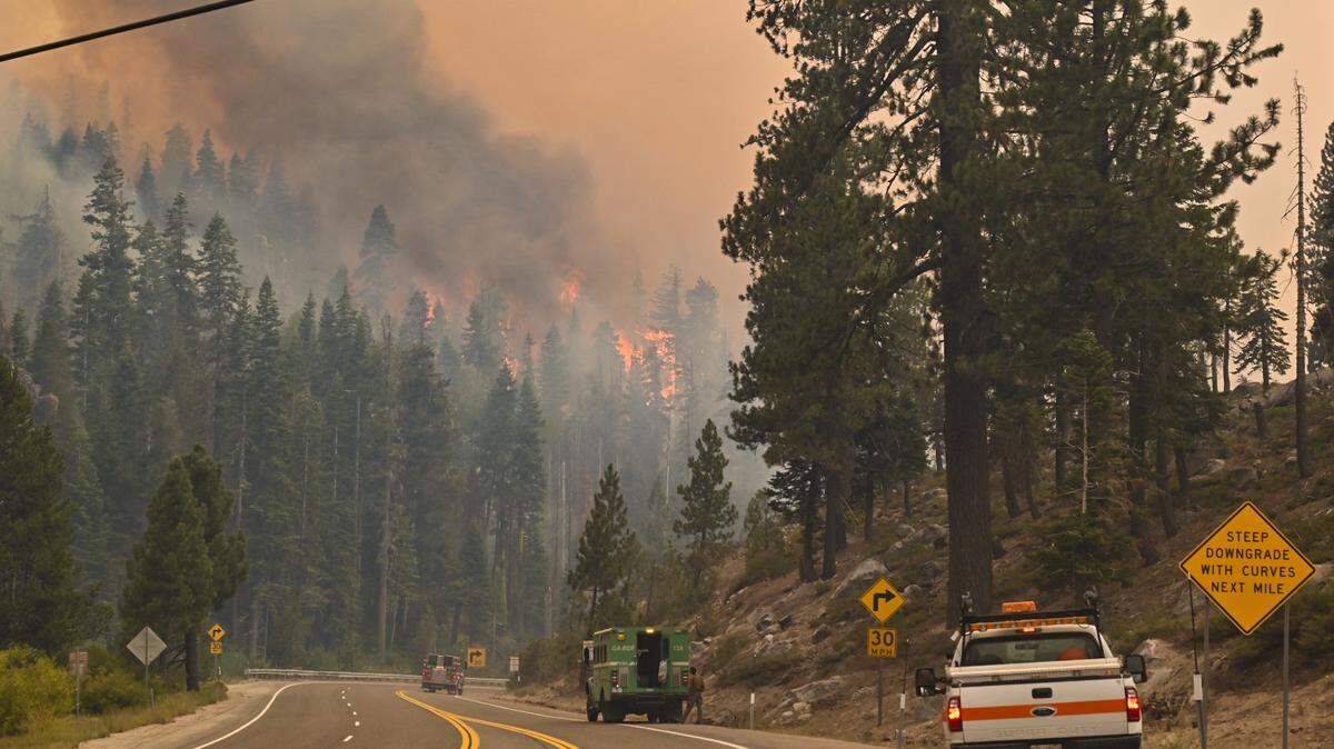
A nearly 50-mile stretch of Highway 50 between Pollock Pines and Meyers remains closed. Highway 88 is also closed for a similar length, between the Dew Drop bypass in Amador County to Picketts Junction with Highway 89 in Alpine County, according to Caltrans.
Those evacuating from areas near South Lake Tahoe must either head on Highway 89 along the west side of the lake — which is under an evacuation warning as far north as Tahoma — or Highway 50 on the east side, into Nevada at Stateline.
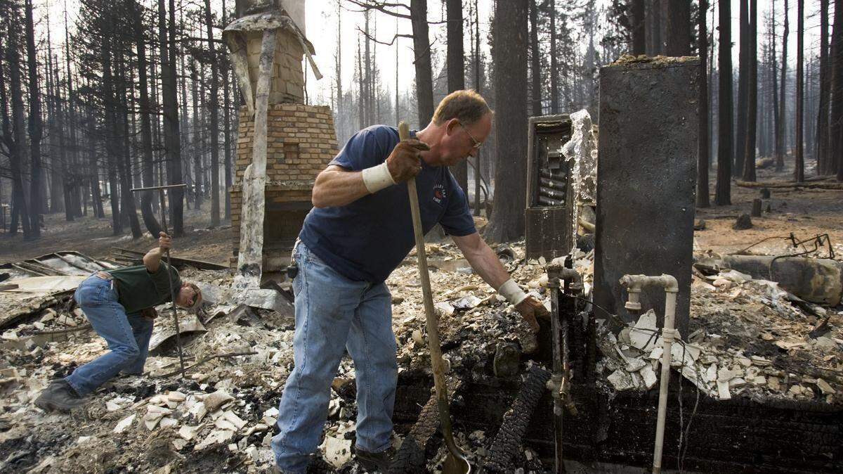
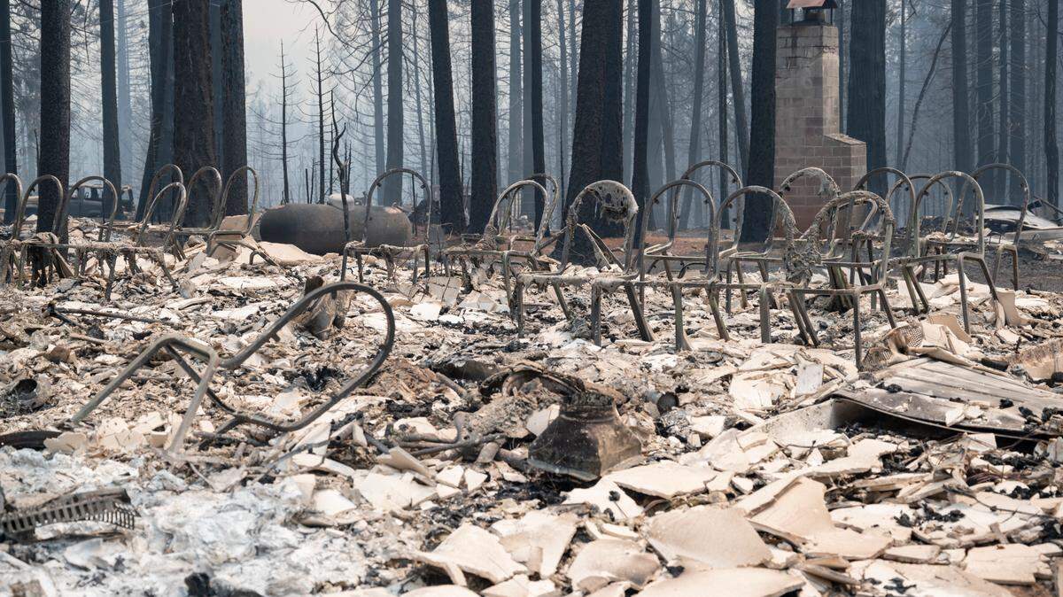
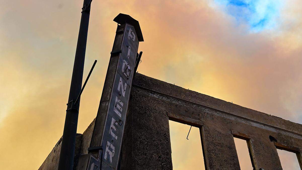
More than 20,000 structures are threatened by the Caldor Fire and nearly 500 homes have already been destroyed, many of them in the town of Grizzly Flats south of Pollock Pines, according to Cal Fire and the U.S. Forest Service.
How much has burned?
The Caldor Fire reached 186,586 acres (290 square miles) with 15% containment, officials said Monday evening. It grew nearly 10,000 acres overnight and another 10,000 acres during the day Monday.
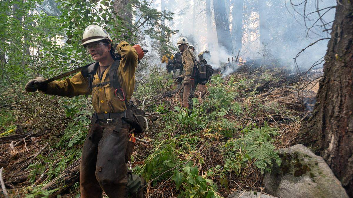
The fire is spotting ahead of itself with embers traveling up to half a mile, Cal Fire said in its morning incident update.
“Fuel conditions remain critical and we still see active crown runs and group torching in the northeastern divisions of the fire,” which is near Tahoe, the Monday morning incident report reads in part.
Some may choose to evacuate ahead of mandatory orders. Barton Memorial Hospital, which has 63 patient beds and a skilled nursing facility with 48 resident beds, said Sunday night it was evacuating those patients. The hospital’s emergency department remains open as of Monday morning.
The blaze sparked Aug. 14 in rugged terrain south of Pollock Pines. It erupted in its early days, largely destroying the town of Grizzly Flats and prompting urgent evacuations for the Pollock Pines, Sly Park and Kyburz areas. The fire has crept east along Highway 50 over the past two weeks, burning this past weekend on both the north and south sides of the highway.
The Governor’s Office of Emergency Services said Sunday evening that nearly 30,000 residents have evacuated from El Dorado County, plus nearly 4,000 more from Amador and Alpine counties, due to the Caldor Fire.
Two civilians have been injured by the Caldor Fire, both of them in Grizzly Flats, along with three first responders, according to Cal Fire and the Forest Service.
Poor weather outlook
Fire risk is dire this week due to gusty winds and low humidity with Caldor already raging.
The National Weather Service has issued a red flag warning for critical fire weather conditions, in place for much of the Sierra Nevada mountains and surrounding foothills from 2 p.m. Monday to 11 p.m. Wednesday. It had originally been set to expire Tuesday night but was extended by 24 hours due to worsening forecasts.
Forecasters now predict gusts blowing in from the southwest could reach up to 25 mph near South Lake Tahoe on Monday, 30 mph on Tuesday and 25 mph again Wednesday.
The red flag warning also warned that gusts along Sierra ridge lines could hit 50 mph Monday night into Tuesday.
The winds are southwesterly, meaning they are blowing the Caldor Fire toward South Lake Tahoe.
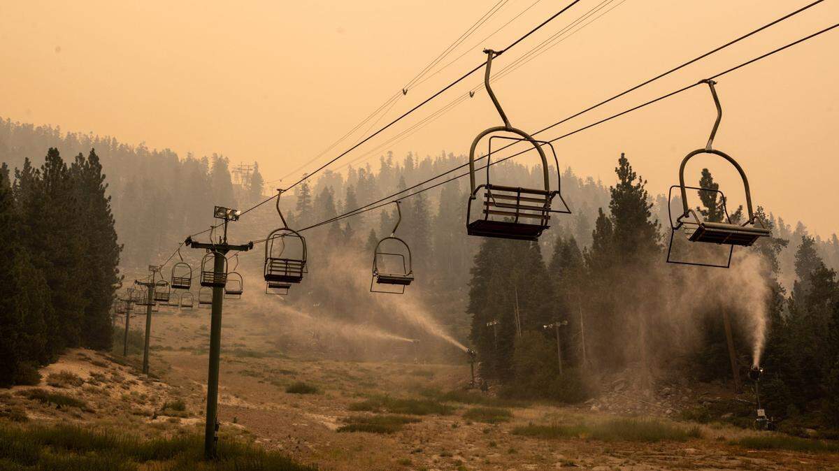
Ski resort, fabled campground survive
Further down the hill, there was some good news to report. Camp Sacramento, a cherished family camp run by the city of Sacramento just south of 50, was still standing.
So, too, were nearly all of the structures at Sierra-at-Tahoe ski resort, just west of Echo Summit.
At the ski resort, the fire burned completely up the ski runs and through the heavily forested area. But firefighters were able to save the entire area except for a vehicle maintenance shed. The ski lifts were intact, as was the main lodge, where a snow-making machine was spraying water to keep the lodge from burning.
Near the burned maintenance shed, another snow-maker was hosing down a propane tank.
Just east of the resort, the Lodge at Adventure Mountain was still standing as well.
Abbey Pearson, who lives in a small A-frame house on a meadow near Sierra-at-Tahoe, said she learned early Monday that her home was undamaged.
“As of today,” she added. “I don’t know what’s going to happen tonight.” She said she’s been told that many of the cabins nearby have been destroyed; some of them had been in the same families for generations.
Pearson evacuated to a friend’s house in South Lake Tahoe and was awaiting word on whether she would have to flee again.
Pearson’s property, at around 6,800 feet of elevation just south of 50 at the turnoff for Sierra-at-Tahoe, is a historic spot. It’s been a cattle ranch and stagecoach stop. It’s also the spot where, every month during winter, the state Department of Water Resources holds its survey to gauge the depth of the Sierra snowpack. In April 2015, during the worst of the last drought, then-Gov. Jerry Brown famously walked through the barren field and ordered mandatory cutbacks in water consumption.
Pearson’s mom, Carol, lived on the property until it was destroyed by fire two years ago.
This story was originally published August 30, 2021 at 7:54 AM with the headline "Live Updates: Caldor Fire reaches basin, jumps Highway 89 as South Lake Tahoe evacuates."

.JPG)