As of Tuesday morning, the blaze was approximately 14% contained, according to the California Department of Forestry and Fire Protection.
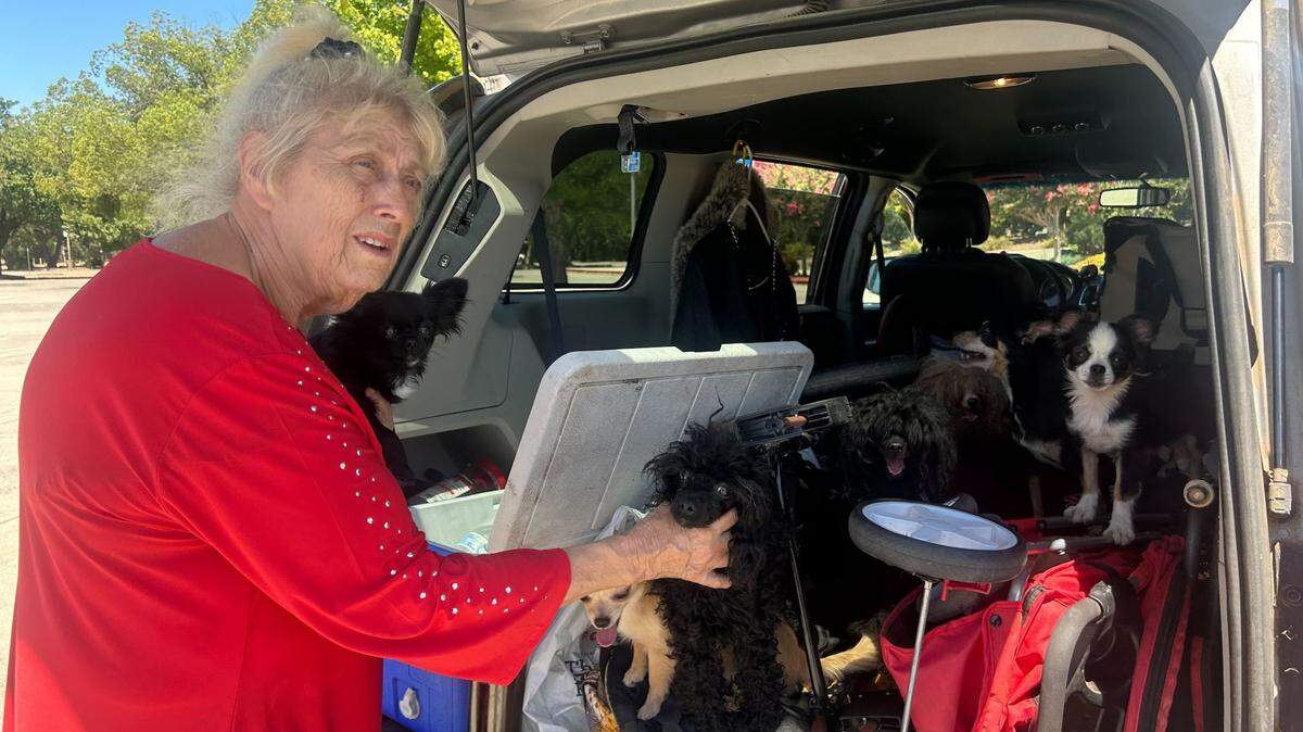
Here’s what to know about Park Fire evacuation zones, centers and tips:
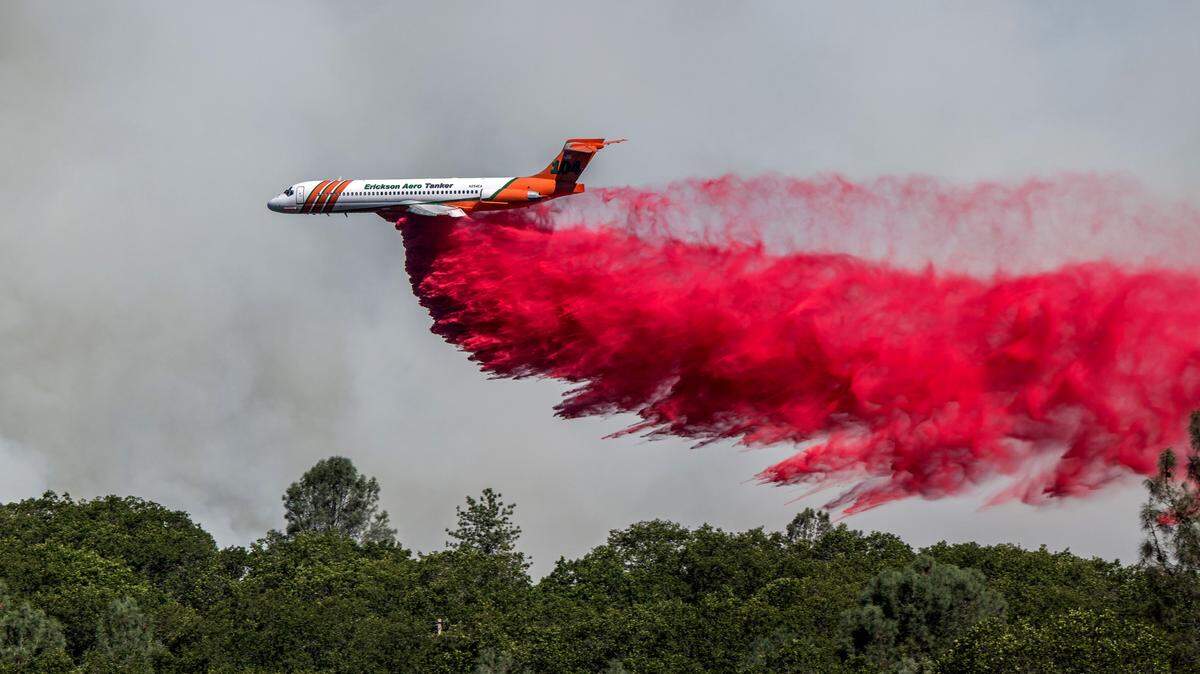
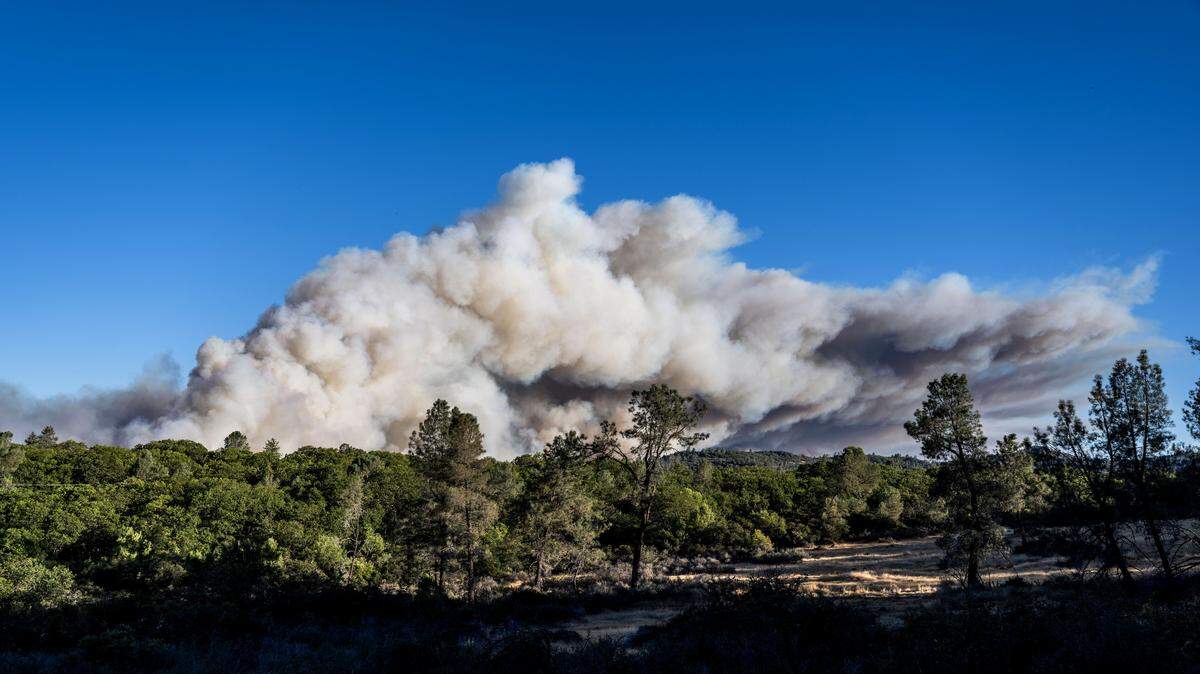
Park Fire: Butte and Tehama counties
Red circles on this live-updating map are actively burning areas, as detected by satellite. Orange circles have burned in the past 12 to 24 hours, and yellow circles have burned within the past 48 hours. Yellow areas represent the fire perimeter.Source: National Interagency Fire Center
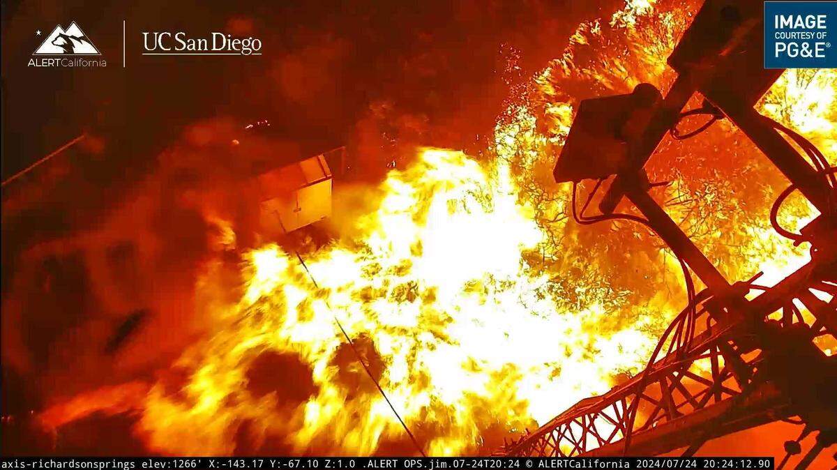
Flames are seen at the base of a communications tower along Richardson Springs Road and Mud Creek before images from the PG&E wildfire camera stopped transmitting Wednesday, July 24, 2024. The Park Fire has burned more than 45,000 acres since sparking Wednesday afternoon. AlertCalifornia/UC San Diego
Where are evacuations for Park Fire in Butte County?
The Butte County Sheriff’s Office issued evacuation orders for the following zones: 120, 149, 150-A, 250-253, 260, 261, 262, 265-271, 273 311, 312, 317 and 318.
These areas include Forest Ranch, Cohasset, Carpenter Ridge and the Chico Municipal Airport.
Additionally, evacuation warnings were given for zones 244, 252, 253, 263, 264, 282, 286, 314, 315, 316, 361 and 363 in Butte County.
Paradise was the site of the 2018 Camp Fire, California’s deadliest and most destructive wildfire.
Burning 90,000 acres in its first 24 hours, the Camp Fire killed 85 people and destroyed more than 18,000 homes and other buildings. Ultimately firefighters stopped the decimation at more than 150,000 acres.
Which areas of Tehama County are under evacuation orders?
The Tehama County Sheriff’s Office ordered zones 694-B, 726, 732, 734, 736, 852, 854, 856, 858, 882, 882-A and 882-B to leave the area.
Residents in zones 694-A, 720, 726, 728, 732, 734, 840, 850-A and 852 were under an evacuation warning.
By Thursday afternoon, the wildfire spread north to Campbellville, prompting the Tehama County Sheriff’s Office to call for mandatory evacuations in the area.
The remains of a structure burned the Park Fire smolder along Cohasset Road east of Chico on Thursday. Hector Amezcua hamezcua@sacbee.com
What about Shasta County?
The Shasta County Sheriff’s Office ordered residents of zones MAN-5000, MAN-5010, MAN-5020, MAN-5030, MAN-5040, MAN-5050, MAN-5060, SHI-5070-A, SHI-5070-B, SHI-5120-A, SHI-5140, SHI-5150, SHI-5170, SHI-5180, SHI-5190-B, SHI-5210, SHI-5220, SHI-5230, SHI-5240-A, SHI-5250, SHI-5260, SHI-5270, SHI-5330-A, SHI-5340-A and SHI-5350-A to leave the area.
These zones can be found by going to Genasys Protect, law enforcement officials said on Facebook.
The park announced on X that campgrounds have been evacuated and reservations are canceled.
“The fire has potential to reach both Manzanita Lake and Mineral (headquarters),” park officials said on Saturday. “Highway 89 through the park is open only for evacuation.”
What is my fire evacuation zone?
California residents can check the status of their area in fire emergencies by entering their address into the search bar of Genasys Protect to see which zone they are in and how they need to respond to Cal Fire’s instructions.
Outbuildings are seen charred from the Park Fire in Butte County, northeast of Chico, on Thursday, July 25, 2024. The fire jumped to more than 45,000 acres less than a day after sparking in Upper Bidwell Park, prompting evacuations. Hector Amezcua hamezcua@sacbee.com
What should I have in an emergency kit during an evacuation?
A home emergency kit should include:
Water — each person needs at least one gallon per day
Nonperishable food items like granola, protein or fruit bars, peanut butter, dried fruit, canned juices
Flashlights
Extra batteries
Battery packs for cellphones
Can opener
Moist towelettes for personal sanitation
A wrench to turn off utilities
First aid kit
A car emergency kit should include:
Jumper cables
Flares or reflective triangle
Ice scraper
Portable cellphone charger
Blanket
Map
Cat litter or sand to help with better tire traction
Angela Rodriguez is a service journalism reporter for The Bee. She is a graduate of Sacramento State with a bachelor’s degree in journalism. During her time there, she worked on the State Hornet covering arts and entertainment.