Atmospheric river isn’t done dumping rain yet in Fresno. But a storm break is ‘in sight’
The San Joaquin Valley’s wet weather over recent weeks is not expected to slow down this week as infrastructure failures and flooding have been an issue.
Fresno could see an inch to 1.5 inches from late Friday into early Saturday as part of the atmospheric river in recent weeks, the National Weather Service in Hanford said Wednesday.
That’s on top of what has been a rainy season of 8.23 inches since Oct. 1, which is double the region’s yearly average for that same time, records show.
If predictions hold, the rain total at the end of the week will be very close to the 30-year normal of 10.99 inches for the entire wet season through Sept. 30.
The rainfall over 24 hours from Monday morning to Tuesday morning was the third wettest in California since 2005, according to the weather service.
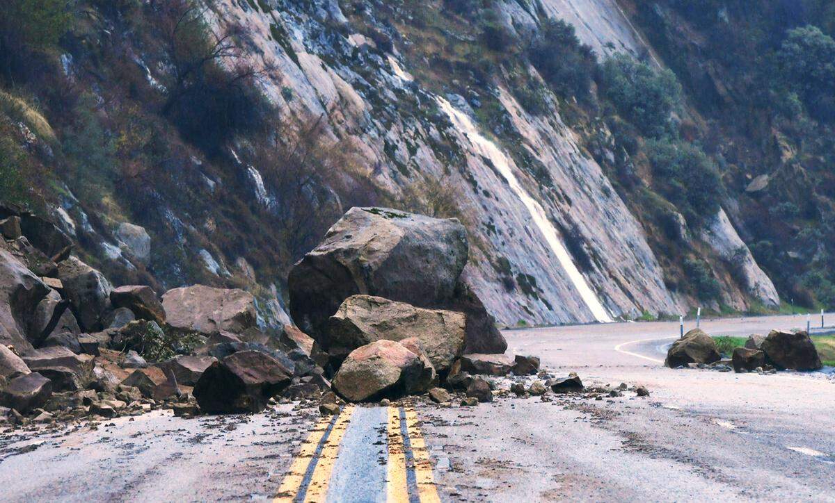
Eastern Fresno County’s foothills recorded heavier rain that led officials to close a number of roads, including the main route to Shaver Lake: the four-lane section of Highway 168, which was shut down Monday because of a rockslide.
One lane of controlled traffic was back open Tuesday afternoon.
Flood warnings remained in place in Merced County where unincorporated areas outside the city of Merced have been particularly hurt by flooding.
Some patches of the city of Merced were also ordered to evacuate. The county’s 10.77 inches of rain for the wet season was about 249% of an average year, the weather service said.
There is a respite in sight, according to Daniel Swain, a climate scientist at UCLA’s Institute of Environment and Sustainability. Though there will be additional flooding in areas, the atmospheric river will come to an end.
“And there is now a plausible end in sight: multi-model ensembles continue to suggest a return to a West Coast ridge pattern in about 9-10 days (by Jan. 20),” he tweeted. “Probably giving folks a much-needed chance to dry out and dig out.”
Fresno County road closures from storm
▪ Highway 168 into Shaver will have only one of its four lanes open with traffic control around the rockslide. Caltrans is escorting with a pilot car.
▪ Trimmer Springs Road (at Maxon)
▪ Copper Avenue (East of Armstrong)
▪ Los Gatos Road (Derrick to County Line)
▪ Fairfax Avenue (Shields to Panoche)
▪ Huntington Lake Road (168 to Big Creek)
▪ Hume Road (180 to Hume Lake)
▪ Belmont Avenue (San Diego to Fairfax), Mendota
▪ Washoe Road (California to Belmont), Mendota
▪ Lyon Avenue (California to Belmont), Mendota
▪ Shaw Avenue (Washoe to Douglas), Firebaugh
▪ Douglas Avenue (Shaw to Bullard), Firebaugh
▪ Bullard Avenue (Washoe Ave to Douglas Ave), Firebaugh
▪ Jerrold Avenue (Nees to Herndon)
▪ Mt. Whitney Road (Sonoma to SR33), Coalinga
▪ Mendota and Parkfield Grade, Coalinga
▪ Auberry Road (Completely closed at Alder Springs, but other areas are for local traffic only), Auberry
Closed parks and recreation areas
▪ Lost Lake Recreation Area
▪ Choinumni Park
For questions, information or assistance, call 211 or visit Fresno County’s storm resources page, fresnocountyca.gov/emergency.
This story was originally published January 11, 2023 at 1:27 PM.